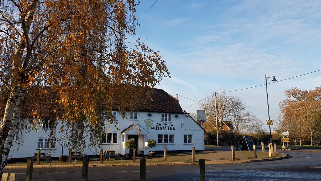
Scenario Planning
Quick Summary
This page explains what scenario planning is and outlines three possible growth options for the future of Arborfield and Barkham.
Scenario planning is a way of thinking ahead. The Parish Councils have created “what-if” housing growth scenarios to explore different ways the area could change over the long term. These scenarios are not predictions or targets. They are tools to test how much growth the area could manage, where development might or might not go, and what infrastructure and services would be needed. They are based on a set of shared assumptions, including existing planning decisions, current transport proposals, limits in the road network, and a strong desire to protect the rural setting and prevent settlements from merging.
Three broad approaches are being explored: building on all available land, continuing to expand existing urban areas, or focusing higher-density development around centres to support public transport and active travel. Each option would bring new homes, population growth, pressure on schools, health services and roads, and different risks to green spaces and local identity. A separate environmental assessment is also reviewing potential impacts on natural and heritage assets.
What is Scenario Planning?
Scenario planning is a way of thinking about the long-term future of an area in order to ensure that any new growth is delivered in a way that serves your community. The Parish Councils have created a number of “What-If” growth scenarios.
As well as being about where housing growth could occur, they are also about where it should not grow and at what point the area will reach saturation point. Whilst it is very possible that some elements of these scenarios might occur, we are not trying to predict the future. We are simply looking at different ways in which future housing growth could come forward in our local area so that we can be better prepared for it and help to shape it for the benefit of the community. We understand that this will instigate difficult conversations as growth normally requires trade-offs, but we consider that there is a need to be better prepared so that the trade-offs are informed by local community preferences. The Parish Councils feel that it is more advantageous to have input into future planning decisions rather than have them imposed on us.
Assumptions used to build “What-If” housing growth scenarios under scenario planning
- That the housing allocations in the emerging Wokingham Local Plan, including Loddon Garden Village and Barkham Square, have been completed and services and facilities are operational
- That Wokingham’s proposed Greenways routes are operational meaning we can walk, cycle or ride horses largely traffic free on these routes
- That sites with live planning applications, whether approved or refused, are considered constants in this exercise
- That some infrastructure contribution assumptions have been made which need to be validated by the relevant stakeholders in due course
- That there is a limit to the scale of additional growth that the local constrained highway network can accommodate, and mitigation measures alone won’t solve these unless it forms part of a radical strategy for change (e.g. major new road infrastructure, far more aggressive demand management and the provision of sustainable transport)
- That the development areas within and adjoining the neighbourhood area is too small and constrained to gather the investment required for major new road infrastructure through national transport infrastructure funding schemes
- That there is a desire to protect a shared rural setting from development, and we believe that the wooded hills landscape provides a physical constraint to new major development in this direction
- That it would be desirable to protect settlement areas with a green infrastructure ring to retain identity and protect from coalescence
- That these scenarios are looking over a period well beyond 2050, imagining that the neighbourhood area has grown to its sustainable limits to help decide what kind of growth would be successful and where saturation point may be
Possible Scenarios for Housing Growth
Three possible growth scenarios have been developed to explore how future development could affect the Arborfield and Barkham area. Each scenario looks at what might happen if, for example, around 4,000–6,000 new homes were provided up to 2050 and potentially beyond. This figure is used only to test how much development could realistically be accommodated under different approaches, not to promote development in specific locations or to set a target for growth. The purpose of the scenarios is to understand the limits of sustainable growth and to identify the infrastructure, services and policy choices that would be needed to support the community in the future.
Scenario #1 Build on all available land nominated by landowners
What if the presumption in favour of sustainable development continues to apply in our local area for an extended period?
This might mean new development on all the land that has been made available for development to Wokingham Borough Council. This is what is currently happening without a valid Local Plan or a valid Neighbourhood Plan. This will continue to happen if the Parish Councils do not update their Neighbourhood Plan, including housing allocations, as there will be no planning defence without it and the Local Plan.
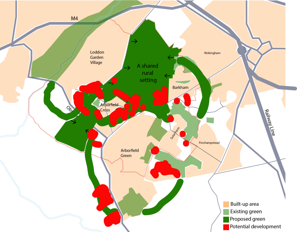
*The above diagram is purely illustrative as to where development could happen in this scenario.
Key Features
- Between 4,000 – 6,000 new homes at low density (up to 30 dwellings per hectare)
- Population increases by approx. 10,000 – 14,000
- May mean 2 new primary schools (with integrated early years) are needed
- The northern suburb of Barkham and southwest of Arborfield Green may be the best locations for these schools
- Population increase requires 6 new GPs, but no clarity available on where, and if, this would be accommodated
Concerns About Scenario #1
- Secondary school places may become an issue as this development scale is unlikely to raise enough funding for a new secondary school
- The possibility of achieving part of the proposed Arborfield Green, Arborfield Cross and Loddon Garden Village green infrastructure ring but there is a risk of coalescence between these three settlements if development is not managed carefully
- Development encroaches onto the shared rural setting
- Growth Swallowfield and Finchampstead will not be within the control of a revised Arborfield and Barkham Neighbourhood Plan (locations cited are in Swallowfield and Finchampstead parishes)
- There is significant risk that this scale of additional development would exceed what the highway network and transport facilities can reasonably accommodate without a radical change in strategy (e.g. far more aggressive demand management and sustainable transport, or major new road infrastructure)
- Piecemeal development is unlikely to properly invest in any kind of radical strategy that is beneficial for the community
Scenario #2 Persistent Urbanism
What if the next waves of plan-making involve the same type of sites being approved as before, intensifying and expanding urban and suburban areas, and expanding existing villages?
It may be convenient for the planning authority to extend existing new developments, utilising recently built amenities and infrastructure. Additional add-ons to Arborfield Green and Loddon Garden Village may be considered. Under this scenario, contributions to infrastructure would not be large-scale but would smaller, possibly targeted towards network upgrades, traffic management and active and sustainable travel with uncertainty over delivery being well-timed or coordinated
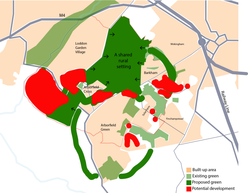
*The above diagram is purely illustrative as to where development could happen in this scenario.
Key Features
- Between 4,000 – 6,000 new homes at medium density (up to 50 dwellings per hectare)
- Population increases by approx. 10,000 – 14,000
- May mean 3 new primary schools (with integrated early years) are needed
- The most appropriate locations for these would be one at each of the extensions to Wokingham, Loddon Garden Village and Arborfield Green
- May mean 1 new secondary school is needed
- The most appropriate location for this is potentially the extension to Loddon Garden Village
- Population increase requires 7 new GPs, but no clarity available on where, and if, this would be accommodated
Concerns About Scenario #2
- The possibility of achieving a part of the proposed Arborfield Green, Arborfield Cross and Loddon Garden Village green infrastructure ring but there is a risk of coalescence between these three settlements if development is not managed carefully
- No encroachment into the shared rural setting
- The Northern portion of Barkham risks coalescence with Wokingham Town if the development is not managed sufficiently to deliver a green corridor to separate the two settlements
- Growth at Arborfield Green, Finchampstead and adjacent to Barkham will not be within the control of a revised Arborfield and Barkham Neighbourhood Plan (locations cited are in Wokingham Town and Finchampstead parishes)
- Likely contributions to targeted network upgrades and traffic management and strong policy and investment in active and sustainable travel will be made, as these are within the current and emerging Infrastructure Delivery Plan, intended to cope with the impact of additional development in the area
- There is significant risk that this scale of additional development would exceed what the highway network and transport facilities can reasonably accommodate without a radical change in strategy (e.g. far more aggressive demand management and sustainable transport)
Scenario #3 Multi-Modal Travel Push
What if the next waves of plan-making are directed to focus on alleviating the pressures of vehicular traffic on our local highways network, aggressively encouraging active travel and making regular and rapid buses more viable?
This might mean focusing higher density development where existing and/or new facilities can be accessed within a 10–15-minute walk (i.e. nearer village and neighbourhood centres). The aim would be that developers would be able to fund long term and positive changes to the public transport network as population would be concentrated in defined areas.
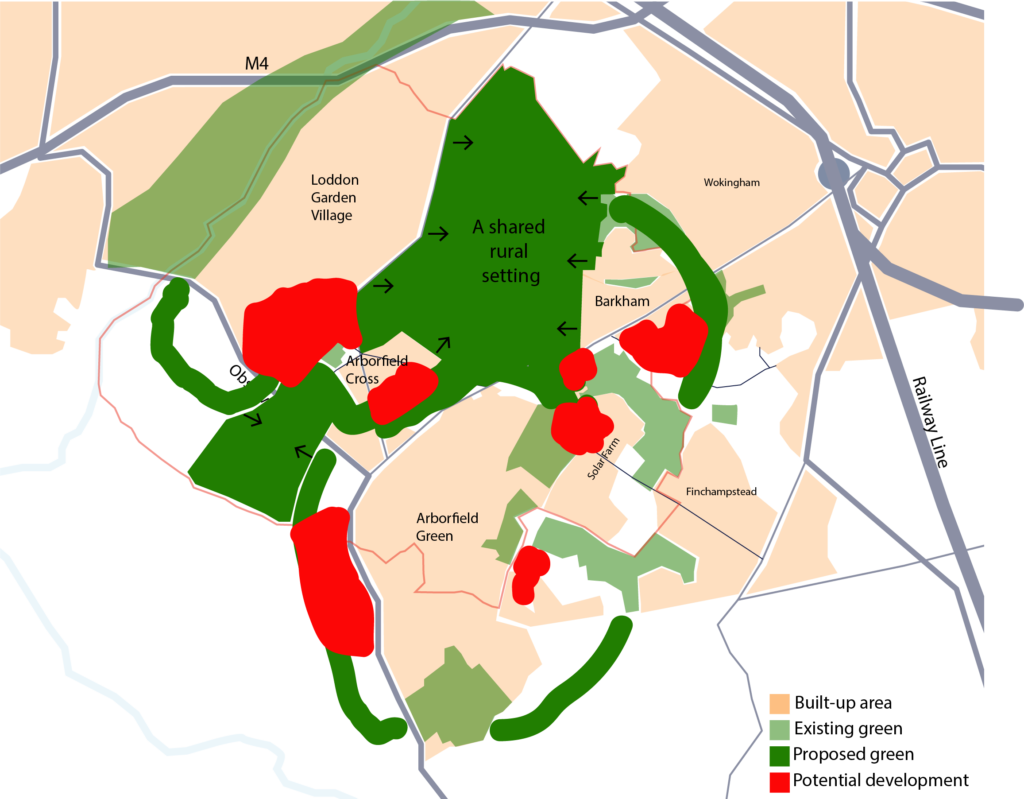
*The above diagram is purely illustrative as to where development could happen in this scenario.
Key features
- Between 4,000 – 6,000 new homes at high density (more than 50 dwellings per hectare)
- Population increases by approx. 10,000 – 14,000
- May mean 3 new primary schools (with integrated early years) are needed
- The most appropriate locations for these would be the extension to Arborfield Green, Barkham Road/Street or the northern suburb of Barkham, and replacement or extension of the existing school at Arborfield Cross
- May mean 1 new secondary school is needed
- The most appropriate location for this is potentially Arborfield Green or Loddon Garden Village
- Population increase requires 7 new GPs, but no clarity available on where, and if, this would be accommodated
Concerns About Scenario #3
- The possibility of achieving a part of the proposed Loddon Garden Village, Arborfield Cross, Arborfield Green, and the historic village of Barkham green infrastructure ring but there is some risk in achieving this in full if development is not managed carefully
- No encroachment into the shared rural setting
- The Northern portion of Barkham risks coalescence with Wokingham Town if the development is not successful in delivering a green corridor to separate the two settlements
- Growth at Arborfield Green and Finchampstead will not be within the control of a revised Arborfield and Barkham Neighbourhood Plan (locations cited are in Swallowfield, Finchampstead and Wokingham Town parishes)
- Contributions for modal filters (perhaps on Barkham Road and Sindlesham/Mole Road) and new greenways (to further connect our communities) free up capacity on the local road network for settlements to absorb additional growth
- A larger concentration of population in specific places could support more frequent buses and make more services and facilities nearby viable
Environmental Assessment
A technical assessment called a Strategic Environmental Assessment (SEA) is being undertaken alongside this Neighbourhood Plan consultation exercise. The SEA has recognised all of the important natural and heritage environment assets which may be affected by any possible future growth. The outcome of this technical assessment will highlight potential natural and heritage environment issues with recommendations for how to avoid, minimise, and mitigate any potential adverse effect.