
Introduction
Quick Summary
This page explains what the consultation is about and why it is taking place now.
The consultation is part of the process of updating the Arborfield and Barkham Neighbourhood Plan, which will help guide future planning decisions in the two parishes. The Parish Councils want the plan to reflect the views of people who live, work, or have an interest in the area. A key focus is how future housing growth could be managed. Through scenario planning, different “what-if” growth options are being explored to help the community think ahead and prepare.
National planning policy places strong emphasis on delivering new housing. Locally, there is currently a short supply of deliverable housing land, which increases pressure for additional development. At the same time, residents have said that important local concerns are often overlooked. These include protecting rural identity and preventing settlements from merging, managing traffic properly, ensuring access to health and community services, and safeguarding heritage, woodland, and green spaces. The consultation aims to gather views so future decisions better reflect these priorities.


WHAT is the consultation about?
Any plans for the future of Arborfield and Barkham, by definition, must involve the input of all stakeholders i.e. all those who work, live and have an interest in the two Parishes.
The Neighbourhood Plan is a plan for all our futures – it is a planning document that may have influence over planning decisions going forward. It needs to be the strongest and best document we can make together, so the Parish Councils are seeking the views of stakeholders in order to ensure they are clearly represented. This will be undertaken through a process of consultation.
The consultation will consider possible future housing growth scenarios and present an important opportunity to involve residents and stakeholders in shaping their community for the future and, in turn, the next phase of the Arborfield & Barkham Neighbourhood Plan.
The consultation will be undertaken through a proposed combination of interactive events, targeted stakeholder engagement, and clear messaging designed to build understanding, encourage constructive contributions and provide the evidence necessary to identify future Neighbourhood Plan content.
WHY do we need to think about the Neighbourhood Plan and further development?
Parishes have already been allocated two large strategic development locations in the Wokingham Local Plan: Arborfield Green and Loddon Garden Village. Given the on-going plans for development in the South East and nationally, it is likely that the demand for significant growth in this part of the Borough will continue.
There a number of factors that point to further housing growth in our area:
Arborfield Green is still in construction and it looks increasingly likely that Loddon Garden Village will go ahead. The emerging Local Plan also proposes a further significant new development at Barkham Square. With these Strategic Development locations being identified, Arborfield and Barkham becomes an easy target for additional growth as significant development has already occurred in our area
Currently, under national planning policy, there is a presumption in favour of sustainable development1 with speculative applications already being approved and the likelihood is that this will continue. This provides us with little defence under planning law when raising objections to the principle of more development
All local authorities in this area have been given a much higher housing requirement figures by central government (Wokingham Borough Council’s target has increased from 748 houses per year to 1,336). These increases have to be accommodated over the next few years, and the targets may increase further
Previous housing (approximately 2,000 dwellings) was built in Wokingham Borough ahead of schedule but these figures have been excluded from future planning targets by central government so the Parishes cannot benefit from this prior overbuild
Even when the emerging Local Plan examination finishes (possibly by early 2027), we anticipate another Local Plan process will need to start being created almost immediately, to meet the requirements of the higher housing targets
Land interests on remaining parcels of available land remain high and developers are hungry to take advantage of this
Arborfield and Barkham are very close to major urban areas with employment, services and facilities which makes development here economically viable and therefore attractive
WBC have already demonstrated their preference to build in the Arborfield and Barkham area rather than other parts of the Borough
Property prices in the area are relatively high making it more profitable for developers to build in this location. Developers set the pace for building, not WBC, so their builds are set to maximise prices not to meet housing need
In addition, the Parishes position, when objecting to planning applications, is weakened by the Local Plan being more than five years old and, therefore, considered out of date as well as our made Neighbourhood Plan not including requirements or locations for potential allocated housing sites.
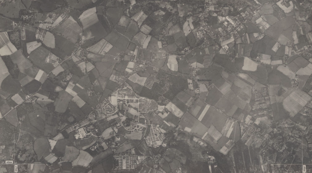
HOW has the area changed over time?
The changes to Arborfield and Barkham over time have been considerable. The years have seen the area change from a predominantly rural, agricultural community to a convenient, built-up centre for access to employment and leisure. The impact on biodiversity and rural countryside has been significant. New technologies now dominate the rural landscape in the form of solar farms in both parishes. More development and more facilities mean that there is more traffic on the roads and more congestion which negatively impacts the rural ambience of the area.
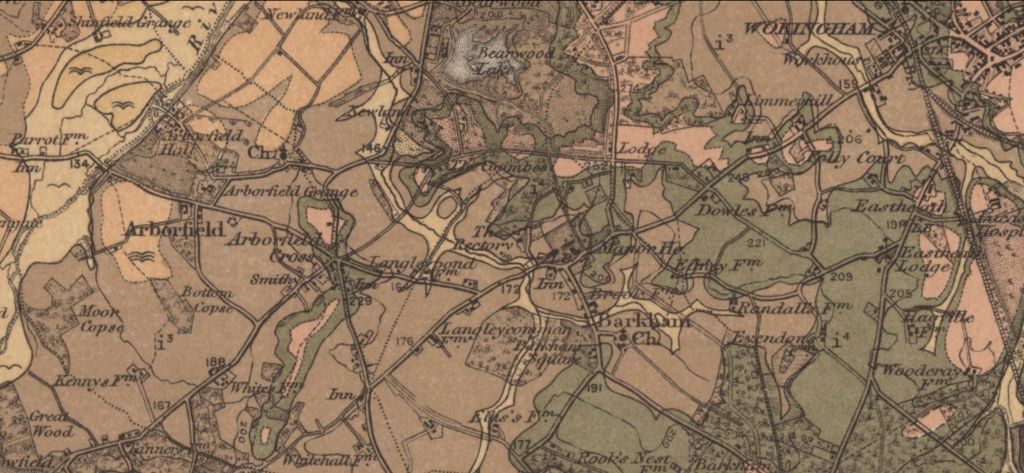
Map of Arborfield and Barkham Surveyed: 1893 reproduced with the permission of the National Library of Scotland. Reuse by CC-BY (NLS).
Map of Arborfield and Barkham Surveyed: 1948 reproduced with the permission of the National Library of Scotland. Reuse by CC-BY (NLS).
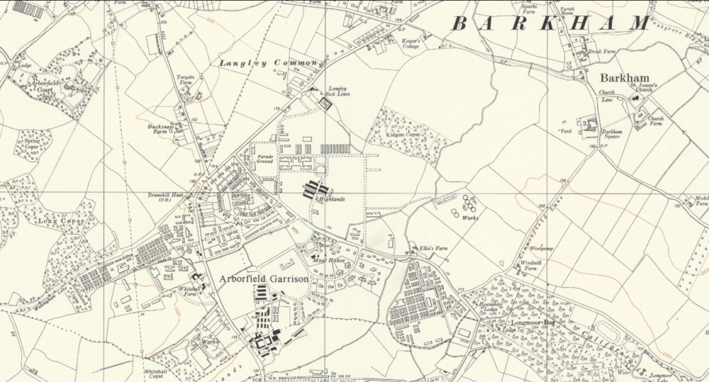
Map of Arborfield and Barkham Surveyed: 1960 reproduced with the permission of the National Library of Scotland. Reuse by CC-BY (NLS).
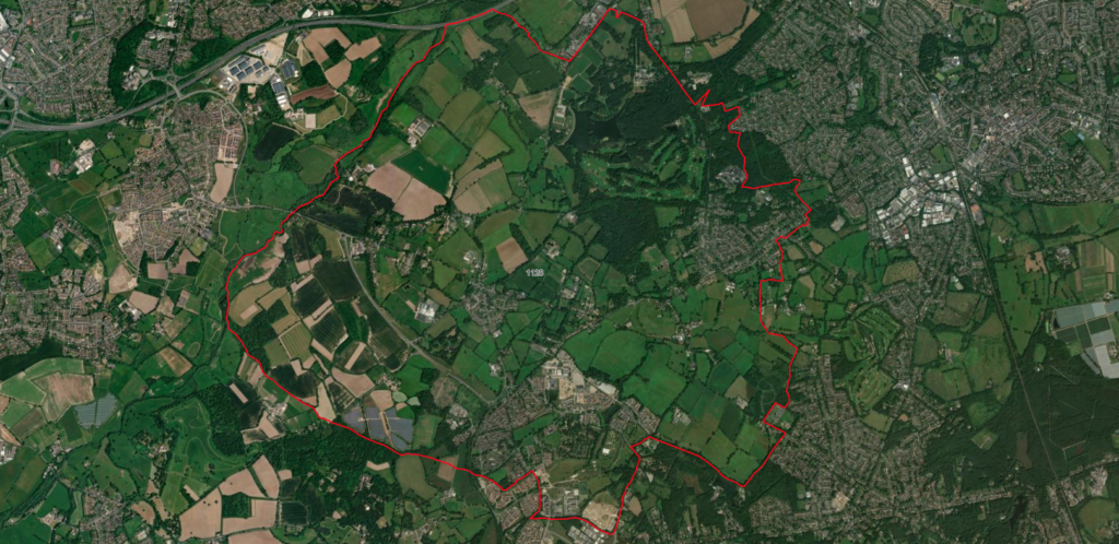
Arborfield and Barkham Aerial view, present
Sources: Microsoft, Vantor contains OS data © Crown copyright and database right 2026
Modern Maps throughout this informational display were created using ArcGIS® software by Esri. ArcGIS® and ArcMap™ are the intellectual property of Esri and are used herein under license. Copyright © Esri. All rights reserved. For more information about Esri® software, please visit
www.esri.com
There is a recognition that time brings change and that some change can be for the good of the community. However, the Parish Councils want to:
- Have some impact on future changes
- Reflect the views of the community about how this development will be most beneficial
- Ensure that the valued elements of this area can be retained
The only way this can be done is by preparing a sound planning document under planning law (the Neighbourhood Plan) following consultation with stakeholders (the Arborfield and Barkham community).
Our Focus?
The need to make provision for new housing continues to carry substantial weight in planning decisions and remains a priority on the national agenda.
There are four important local issues which residents tell us are overlooked when planning decisions are made:
- Retaining rural identity and avoiding coalescence of settlements (by maintaining green infrastructure rings around key settlement areas)
- Managing traffic and transport measures properly
- Access to health and other community infrastructure
- Retaining and protecting local heritage, woodland and green spaces
The parish councils are therefore using a method called scenario planning to help prepare more effectively for the future growth that we think is highly likely to come our way again.
- The presumption in favour of sustainable development applies in full force in planning decisions when the housing land supply is less than 5 years. The 5-year housing land supply for Wokingham Borough is currently 1.7 years so a lot of additional building is required to meet target. The 5-year housing land supply is determined by the rate at which homes are realistically expected to be delivered rather than by the amount of land that is allocated or theoretically available for development. ↩︎